×

Cart

Subtotal:

GARMIN etrex 32x Topo

Explore confidently with the reliable handheld GPS

  • 2.2” sunlight-readable colour display with 240 x 320 display pixels for improved readability
  • Preloaded with TopoActive Europe maps with routable roads and trails for cycling and hiking
  • Support for GPS and GLONASS satellite systems allows for tracking in more challenging environments than GPS alone
  • 8 GB of internal memory for map downloads plus a microSD card slot
  • eTrex 32x adds a 3-axis compass and barometric altimeter
  • Battery life: up to 25 hours in GPS mode with 2 AA batteries

17.980 ден.

SKU : 010-02257-01

Достапност : Распродадено

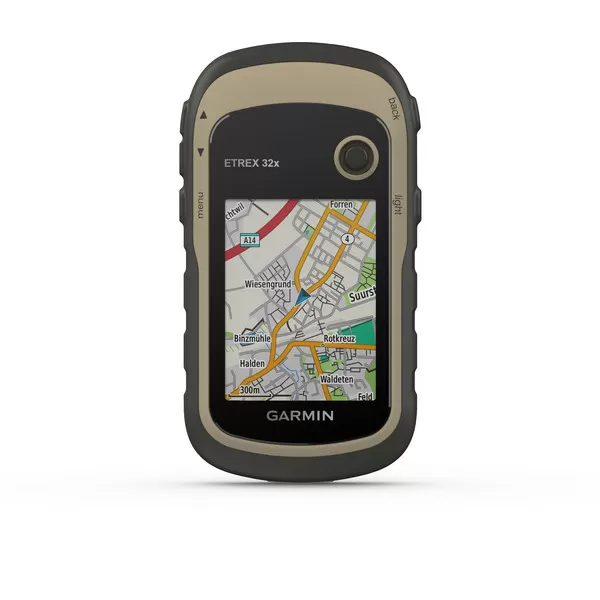
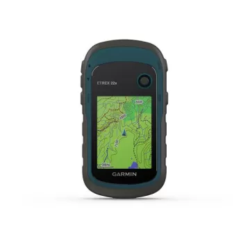
eTrex 22x and eTrex 32x offer the same ease-of-use, durability and affordability that the eTrex handheld GPS series is known for — along with preloaded TopoActive Europe maps. These devices are perfect for quad bikes, bicycles, boats or hiking.

See the way

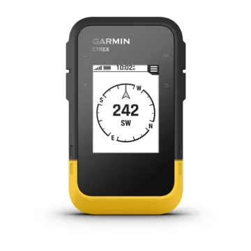
eTrex 22x and 32x offer enhanced 2.2”, 65K colour, sunlight-readable displays. Durable and water resistant, these handhelds are built to withstand the elements.

Explore the terrain

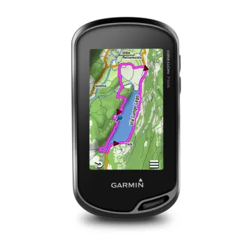
The eTrex 22x and 32x handheld devices come preloaded with road-routable TopoActive Europe maps that feature streets and trails so you can take the journey off the grid. Now you can know your surroundings — such as waterways, natural features as well as buildings, international boundaries and more. You can also find thousands of points of interests, including shops, restaurants, universities, car parks and accommodations.

Keep your fix

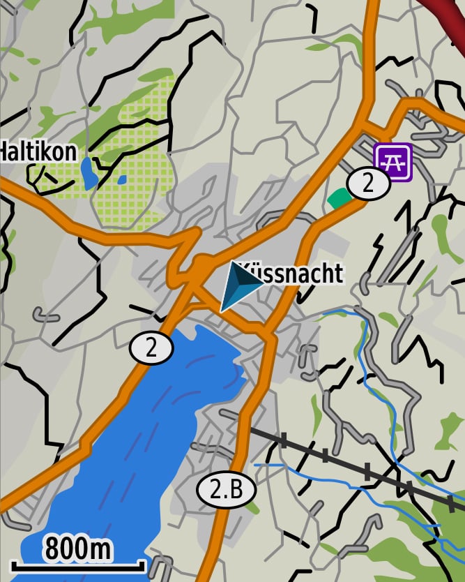
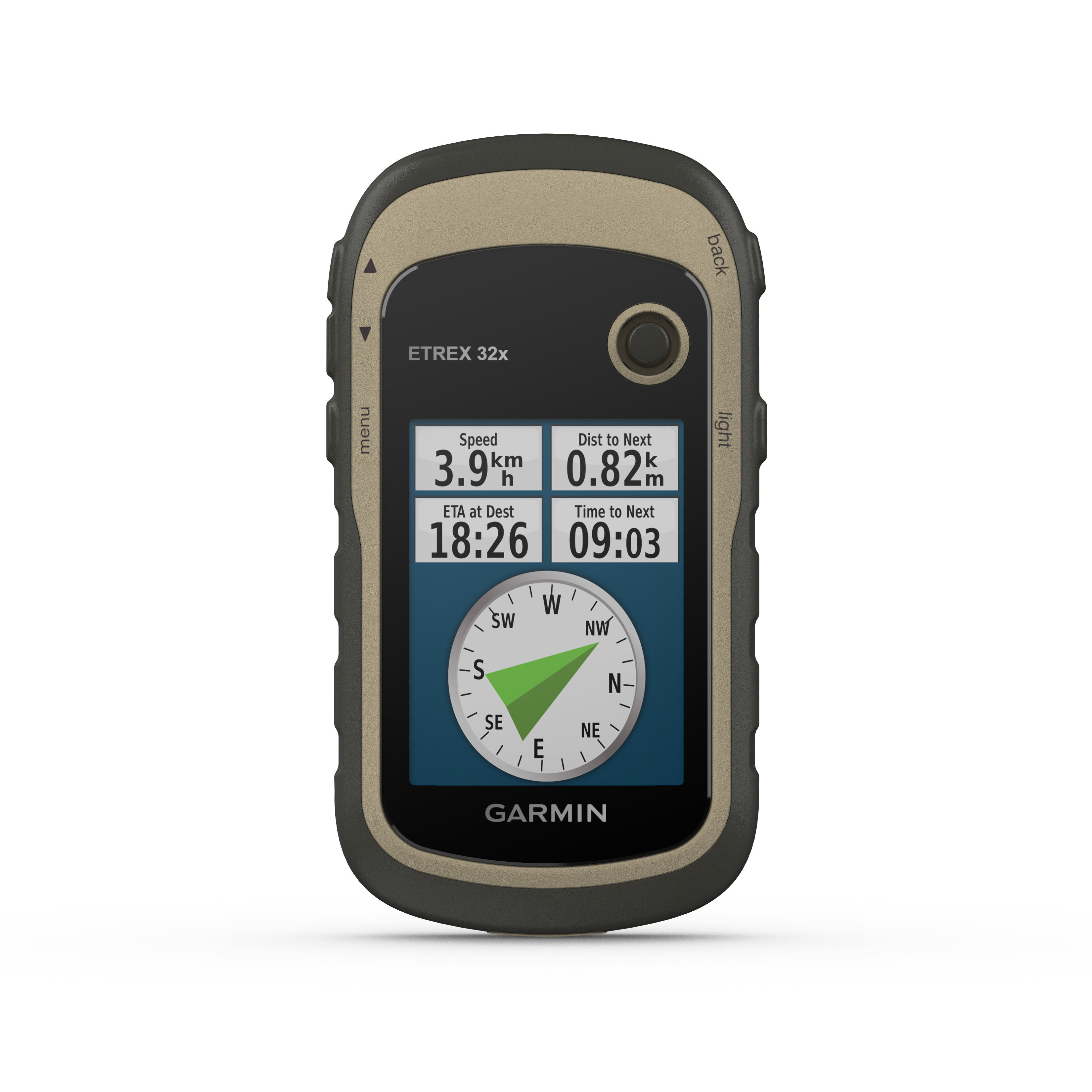
The eTrex series uses both GPS and GLONASS satellite systems so the receiver has the ability to track in more challenging environments than GPS alone. eTrex 32x adds a 3-axis compass and barometric altimeter, making it easy for you to keep your bearings.

Add maps

With a microSD card slot and expanded 8 GB of internal memory, you can easily download additional maps for wherever the adventure takes you.

Satellite imagery

Both devices support BirdsEye Satellite Imagery (subscription required), so you can download and integrate satellite imagery with your maps.
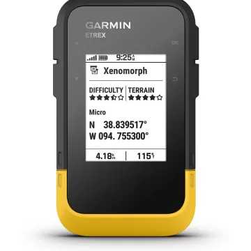
Find fun

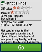
eTrex 22x and eTrex 32x support paperless geocaching. Upload GPX files straight to your device, and view key information such as location, terrain and hints from Geocaching.com.

Go anywhere

With an array of compatible mounts, eTrex is designed as an outdoor handheld GPS ideal for use on quad bikes or bicycles, in boats or on foot. Use the auto mount capability and City Navigator® NT maps for turn-by-turn driving directions, or use the rugged mount for your motorcycle or quad bike. Wherever you think you might take eTrex, it has the mapping and mounts to get you there.

TestVar id: 35 userid: 17 name: GARMIN Oregon® 750t TopoActive Europe VIP: 0 cat: 46 subcat: 3 subsubcat: 0 manufacturer: model: status: 1 image1: 17_2024_81511714007340.webp image2: 17_2024_64531714007340.webp image3: 17_2024_73261714007340.webp image4: 17_2024_42181714007340.webp image5: 17_2024_47611714007340.webp image6: image7: image8: image9: image10: image11: image12: short_description: <h3>Rugged GPS/GLONASS Handheld with Built-in Wi-Fi®, Camera and TopoActive maps</h3> <ul> <li>Enhanced antenna enables better GPS and GLONASS reception and performance; 3-axis compass with accelerometer and barometric altimeter sensors</li> <li>3-inch sunlight-readable touchscreen with dual orientation (landscape or portrait view)</li> <li>Expanded wireless connectivity (Wi-Fi, Bluetooth<sup>®</sup>, ANT+<sup>®</sup> capable); includes Smart Notifications<sup>1</sup> and automatic uploads to Garmin Connect<sup>™</sup> online community and supports Active Weather and Geocaching Live</li> <li>8 megapixel autofocus camera which automatically geotags photos</li> <li>Preloaded TopoActive Map of Europe and included 1-year BirdsEye Satellite Imagery subscription</li> </ul> description: <div> <div><img class="bottom-s alignleft" src="https://static.garmincdn.com/en_GB/products/010-01672-31/g/at-a-glance.jpg" alt="At a Glance" width="100%" height="" border="0" /></div> <div> <div class="row top-m bottom-m"> <div class="span5"><img src="https://static.garmincdn.com/en_GB/products/010-01672-31/g/intro.jpg" alt="" width="200" height="" border="0" /></div> <div class="span10"> Thanks to an enhanced antenna for better satellite reception, the Oregon 750t GPS and GLONASS handheld puts even more of the great outdoors at your fingertips. Whether you’re hiking, biking, geocaching, climbing, kayaking, trail riding or whatever, this rugged navigator is ready for anything. It features multilink wireless connectivity (Wi-Fi, Bluetooth and ANT+), Active Weather support with animated radar overlays, a 1-year <a href="https://buy.garmin.com/prod70144.html" target="_blank" rel="noopener">BirdsEye Satellite Imagery</a> subscription and a built-in 3-axis compass with barometric altimeter. </div> </div> <h3>More Connectivity, Less Complexity<sup>1</sup></h3> <div class="row top-m bottom-m"> <div class="span9"> The expanded wireless capabilities of Oregon 750t make it easier than ever to update software, receive Smart Notifications<sup>1</sup> check the weather radar<sup>2</sup> and upload adventures to <a href="https://connect.garmin.com/" target="_blank" rel="noopener">Garmin Connect</a>. You can even share LiveTrack location data or geocache discoveries via WiFi or smartphone. Smart Notifications via Bluetooth connectivity with a compatible smartphone let you receive emails, texts and alerts right on your device. So you can see what’s going on while you’re getting away from it all. Comes standard with a dual battery system that lets you use traditional AA batteries or a rechargeable NiMH power pack. </div> <div class="span9"><img src="https://static.garmincdn.com/en_GB/products/010-01672-31/g/hike.jpg" alt="" width="200" height="" border="0" /></div> </div> <div class="row top-m bottom-m"> <div class="span9"> <h3>Find Fun with Geocaching.com</h3> The wireless connectivity to <a href="http://www.geocaching.com/" target="_blank" rel="noopener">Geocaching.com</a> on your Oregon makes it easier than ever to enjoy a superior geocaching experience. You can set your device to automatically stay up to date with all the latest caches. No more manual entry of coordinates or printing out cache details on paper. </div> <div class="span9"><img src="https://static.garmincdn.com/en_GB/products/010-01672-31/g/geo.jpg" alt="" width="200" height="" border="0" /></div> </div> <div class="row top-m bottom-m"> <div class="span9"> <h3>Take Geotagged Pictures</h3> Capture locations and memories with the 8 megapixel digital camera. Each photo is automatically geotagged, allowing you to easily navigate back to that exact spot in the future. You can upload and share your favourite photos with friends via <a href="http://adventures.garmin.com/" target="_blank" rel="noopener">Garmin Adventures<sup>™</sup></a>, part of the Garmin online community. </div> <div class="span9"><img src="https://static.garmincdn.com/en_GB/products/010-01672-31/g/geotag.jpg" alt="" width="200" height="" border="0" /></div> </div> <h3>Navigate Your Way</h3> <div class="row top-m bottom-m"> <div class="span9"> The Oregon 750t handheld provides comprehensive navigation and tracking to guide you on and off the beaten path, using GPS and GLONASS plus ABC (altimeter, barometer and compass) sensor capabilities. The built-in altimeter provides elevation data to accurately monitor ascent and descent, while the barometer can be used to predict weather changes by showing short-term trends in air pressure. The 3-axis electronic compass keeps your bearing, whether you’re moving or not. There’s also a TracBack<sup>®</sup> feature on Oregon 750t to help you navigate back to your starting point the same way you came. You can also mark locations, such as your campsite, vehicle or other points of interest, to which you'd like return navigation. </div> <div class="span9"><img src="https://static.garmincdn.com/en_GB/products/010-01672-31/g/nav.jpg" alt="" width="200" height="" border="0" /></div> </div> <h3>Enjoy the View on a Vivid Display</h3> <div class="row top-m bottom-m"> <div class="span9"> The Oregon 750t handheld features a bright, sunlight-readable 3-inch colour touchscreen display with dual orientation for landscape or portrait views. It easily supports multiple mapping options such as <a href="https://buy.garmin.com/prod6452.html" target="_blank" rel="noopener">BlueChart<sup>®</sup> g2 HD</a> for water navigation or <a href="https://buy.garmin.com/c452-c454-c496-p1.html" target="_blank" rel="noopener">City Navigator<sup>®</sup> NT </a>for turn-by-turn driving directions. Durable and <a href="http://www.garmin.com/waterrating/" target="_blank" rel="noopener">water-rated to IPX7</a>, the Oregon series is built to keep delivering vital mapping and tracking data, no matter what the elements throw at you. Plus, you can even customise your Oregon’s display with free downloads from the <a href="https://apps.garmin.com/" target="_blank" rel="noopener">Garmin Connect IQ<sup>™</sup></a> online store<sup>3</sup>. </div> <div class="span9"><img src="https://static.garmincdn.com/en_GB/products/010-01672-31/g/sideview-700.jpg" alt="" width="200" height="" border="0" /></div> </div> <h3>Plan Your Next Trip</h3> Take charge of your next adventure with <a href="http://www.garmin.com/basecamp/" target="_blank" rel="noopener">BaseCamp</a>™, software that lets you view and organise maps, waypoints, routes and tracks. This free trip-planning software even allows you to create Garmin Adventures that you can share with friends, family or fellow explorers online. BaseCamp displays on your computer screen any topographic map data stored on the device, including contour lines and elevation profiles. It also can transfer an almost unlimited amount of satellite images to your device from the included 1-year BirdsEye Satellite Imagery subscription. <p class="disclaimer-block"><sup>1</sup>When paired with a compatible smartphone. See <a href="http://support.garmin.com/support/searchSupport/case.faces?caseId=%7bbbfc9660-8f77-11e3-d5f4-000000000000%7d" target="_blank" rel="noopener">garmin.com/ble</a> for compatibility. <sup>2</sup>Active Weather is available in the UK, Ireland, Portugal, Spain, France, Germany, Belgium, Netherlands, Luxembourg, Switzerland, Denmark, Norway, Sweden, Finland, Austria and Slovenia with partial coverage in Northern Italy. <sup>3</sup>Apps, widgets and data fields will be introduced when they become available; not all products may be available all the time. Please check our <a href="https://apps.garmin.com/" target="_blank" rel="noopener">website</a> for current inventory of Connect IQ products.</p> <p class="disclaimer-block">The Bluetooth® word mark and logos are registered trademarks owned by Bluetooth SIG, Inc. Wi-Fi<sup>®</sup> is a registered trademark of the Wi-Fi Alliance.</p> </div> </div> characteristics: meta_title: meta_keywords: meta_description: url: measure: order_by: 0 image: 17_2024_81511714007340.webp price: 34980.00 price2: 0.00 item_id: 33

Слични продукти