×

Cart

Subtotal:
BLACK FRIDAY 21.11-01.12.2025 - СЕГА Е МОМЕНТОТ ЗА ДОБРА ЦЕНА!  

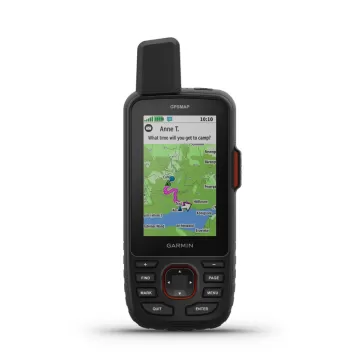
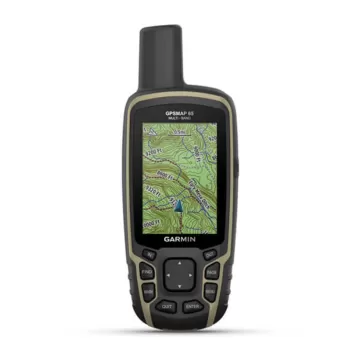
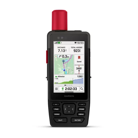
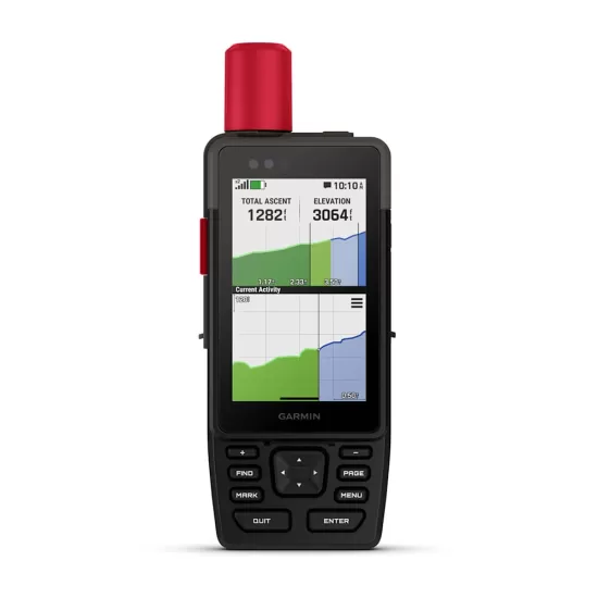
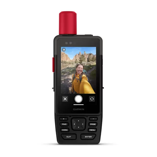
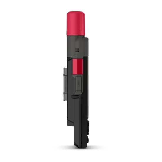
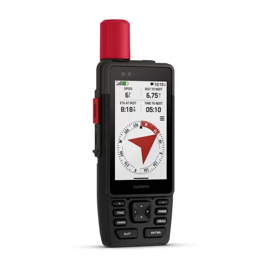
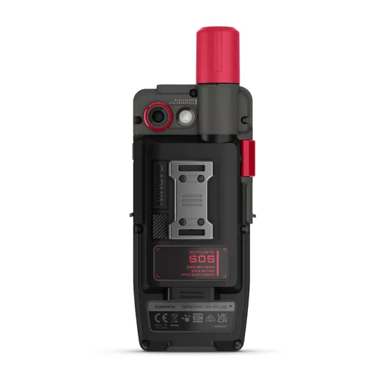
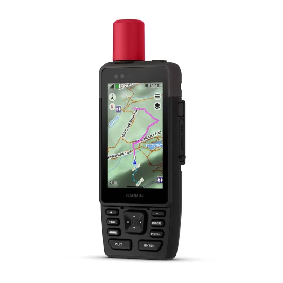
GARMIN GPSMAP H1i Plus

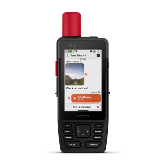
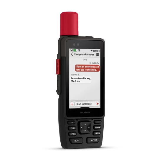
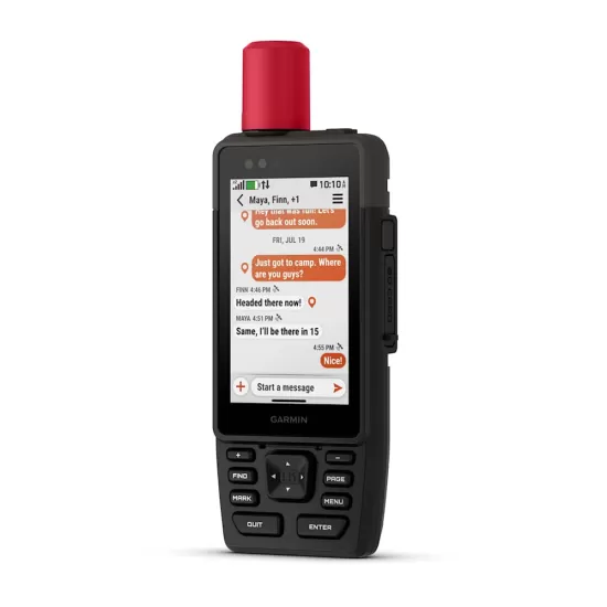
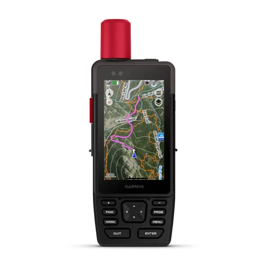
Робустен рачен GPS има модерен дизајн, однапред вчитани мапи и вградена inReach® Plus сателитска технологија за да останете во контакт надвор од покриеноста на мобилната мрежа. Време е да тргнете по патеките.

61.980 ден.
Достапност : Бесплатна достава во Македонија. Рок за испорака 1-3 работни дена.


WHEN ADVENTURE CALLS, RESPOND

This rugged handheld GPS has a modern design, preloaded maps and built-in inReach® Plus technology1 to stay in touch beyond mobile network coverage. It’s time to hit the trails.

HYBRID DESIGN OFFERS A 3.5″ COLOUR TOUCHSCREEN AND PHYSICAL BUTTONS

EXCHANGE PHOTOS, VOICE MESSAGES AND TEXT MESSAGES WITH AN INREACH SUBSCRIPTION1

SEND AN SOS MESSAGE TO THE GARMIN RESPONSE℠ CENTRE FOR HELP IN AN EMERGENCY (SUBSCRIPTION REQUIRED)

PRELOADED TOPOACTIVE MAPS, DOWNLOADABLE SATELLITE IMAGERY AND OPTIONAL OUTDOOR MAPS+ CONTENT

LONG BATTERY LIFE OFFERS UP TO 145 HOURS IN GPS MODE

MULTI-BAND GPS AND MULTI-GNSS SUPPORT HELPS PINPOINT YOUR PRECISE LOCATION

WHAT YOU'LL LOVE

Touchscreen Display

The bright, sunlight-readable 3.5″ colour touchscreen has chemically strengthened glass to resist scratches. It is glove-friendly, easy to see and easy to use. Tap, zoom and swipe on the maps to follow your route.

PHYSICAL BUTTONS

The rugged hybrid design also features intuitive push buttons for more versatility when in weather and while wearing gloves. The quick-action button lets users customise functions to their specific needs.

PHOTOS AND VOICE/TEXT MESSAGING

With an active inReach subscription1, send group text messages up to 1,600 characters. You can also exchange photos and voice messages when outside of mobile network coverage.

SOS ALERTS

Trigger an interactive SOS message anytime to the 24/7-staffed Garmin Response international coordination centre for help in an emergency. This requires an active inReach subscription1.

Advanced Navigation

Navigate with preloaded TopoActive maps for the Europe, Middle East and Africa — and easy-to-access global maps. See terrain contours, elevations, geographical points and more.

SATELLITE IMAGERY

Download high-resolution photorealistic maps directly to your device via Wi-Fi® technology. Find trails, pick stand locations and parking, create waypoints and more.

BUILT FOR ADVENTURE

KNOW THE UNKNOWN


OUTDOOR MAPS+

Purchase an Outdoor Maps+ plan for access to a variety of premium mapping content across the globe. Plans are updated regularly and sent to your device over Wi-Fi.

LOCATION ACCURACY

Get multi-band GPS and multi-GNSS support for superior positional accuracy.

BUILT-IN CAMERAS

The integrated front and back cameras allow you to snap selfies and photos of your trip. With an active inReach subscription1, share your photos in real time even without a mobile network.

VOICE CONTROL

Utilise voice commands to conveniently handle many tasks, including check-ins, start tracking, take a photo and more. Available in Danish, Dutch, English, French, German, Italian, Spanish and Swedish.

LIVETRACK™ SHARING

When you venture off-grid, friends can follow along via satellite technology1 to view your progress, ping your device to see your GPS location and exchange messages. For trips within mobile coverage, loved ones can follow your location in real time and see data such as distance, time and elevation.


GARMIN WEATHER

Get real-time forecast information so you’re aware of the changing conditions. This feature requires an active Wi-Fi connection or an active cellular connection and use of the Garmin Messenger™ app on your paired smartphone. When you travel beyond mobile coverage, access weather updates via satellite1 for your current location, route destination and more.

PLAN YOUR TRIPS

Enjoy seamless trip planning with the ability to easily locate geographic points, share your route and more. This requires an active Wi-Fi connection or cellular connection with use of the Garmin Explore™ app on your compatible smartphone.


EVOLVED DESIGN


HELPFUL TOOLS

Use the built-in bright LED flashlight torch as a beacon or to light your way when the path goes dark. A loud built-in siren can help draw attention if you are in need.

BATTERY LIFE

Long-lasting battery life allows for up to 145 hours in GPS mode.

RUGGED DESIGN

Built to meet MIL-STD 810 for thermal, shock, water (IPX67) and vibration to withstand weather and extreme temperatures.

ON THE GO

This device has an integrated Spine Mount 2 and includes a removable loop with carabiner clip for more versatility on your adventure. It’s also compatible with additional Spine Mount 2 accessories, sold separately.

ABC SENSORS

Get a built-in altimeter for elevation data, a barometer to monitor weather and a 3-axis electronic compass to provide direction.

 
1Satellite subscription required. Some jurisdictions regulate or prohibit the use of satellite communication devices. It is your responsibility to know and follow all applicable laws in the jurisdictions where the device is intended to be used.
2Requires an active cellular connection and use of the Garmin Messenger app on your paired smartphone
Wi-Fi is a registered trademark of the Wi-Fi Alliance.
Engineering enhancements are ongoing and may not be reflected in the pictures, videos and specifications.

TestVar id: 67 userid: 17 name: GARMIN etrex 32x Topo VIP: 0 cat: 46 subcat: 3 subsubcat: 0 manufacturer: model: status: 1 image1: 17_2024_98551714007379.webp image2: image3: image4: image5: image6: image7: image8: image9: image10: image11: image12: short_description: <h3>Explore confidently with the reliable handheld GPS</h3> <ul> <li>2.2” sunlight-readable colour display with 240 x 320 display pixels for improved readability</li> <li>Preloaded with TopoActive Europe maps with routable roads and trails for cycling and hiking</li> <li>Support for GPS and GLONASS satellite systems allows for tracking in more challenging environments than GPS alone</li> <li>8 GB of internal memory for map downloads plus a microSD<sup>™</sup> card slot</li> <li>eTrex 32x adds a 3-axis compass and barometric altimeter</li> <li>Battery life: up to 25 hours in GPS mode with 2 AA batteries</li> </ul> description: <div> <iframe src="https://www.youtube.com/embed/dxPZaeF1eP0" width="700" height="394" frameborder="0" allowfullscreen="allowfullscreen" data-mce-fragment="1"></iframe> </div> <div> eTrex 22x and eTrex 32x offer the same ease-of-use, durability and affordability that the eTrex handheld GPS series is known for — along with preloaded TopoActive Europe maps. These devices are perfect for quad bikes, bicycles, boats or hiking. <h3>See the way</h3> eTrex 22x and 32x offer enhanced 2.2”, 65K colour, sunlight-readable displays. Durable and water resistant, these handhelds are built to withstand the elements. <div class="row top-m bottom-m"> <div class="span12"> <h3>Explore the terrain</h3> The eTrex 22x and 32x handheld devices come preloaded with road-routable TopoActive Europe maps that feature streets and trails so you can take the journey off the grid. Now you can know your surroundings — such as waterways, natural features as well as buildings, international boundaries and more. You can also find thousands of points of interests, including shops, restaurants, universities, car parks and accommodations. </div> <div class="span6"><img src="https://static.garmincdn.com/en/products/010-02256-01/g/eTrex22x_SS_9007-f7e9cef2-39f6-48e3-9c86-ad22de47ac79.jpg" alt="" width="220" height="" border="0" /></div> </div> <div class="row top-m bottom-m"> <div class="span12"> <h3>Keep your fix</h3> The eTrex series uses both GPS and GLONASS satellite systems so the receiver has the ability to track in more challenging environments than GPS alone. eTrex 32x adds a 3-axis compass and barometric altimeter, making it easy for you to keep your bearings. </div> <div class="span6"><img src="https://static.garmincdn.com/en/products/010-02257-01/g/eTrex32x_HR_1002.2-90cdde02-85e0-4740-b1ce-e8b958faaa46.jpg" alt="" width="250" height="" border="0" /></div> </div> <h3>Add maps</h3> With a microSD card slot and expanded 8 GB of internal memory, you can easily download additional maps for wherever the adventure takes you. <h3>Satellite imagery</h3> Both devices support <a href="https://buy.garmin.com/en-GB/GB/p/70144">BirdsEye Satellite Imagery</a> (subscription required), so you can download and integrate satellite imagery with your maps. <div class="row top-m bottom-m"> <div class="span12"> <h3>Find fun</h3> eTrex 22x and eTrex 32x support paperless <a href="https://buy.garmin.com/en-GB/GB/c12521-p1.html">geocaching</a>. Upload GPX files straight to your device, and view key information such as location, terrain and hints from <a href="http://www.geocaching.com/">Geocaching.com</a>. </div> <div class="span6"><img src="https://static.garmincdn.com/en/products/010-02257-00/g/etrex32x_pride_01-02d4fe87-06b2-439c-b020-81388d408521.jpg" alt="" width="250" height="" border="0" /></div> </div> <h3>Go anywhere</h3> With an array of compatible mounts, eTrex is designed as an outdoor handheld GPS ideal for use on quad bikes or bicycles, in boats or on foot. Use the auto mount capability and <a href="https://buy.garmin.com/en-GB/GB/c452-c454-c496-p1.html">City Navigator® NT</a> maps for turn-by-turn driving directions, or use the rugged mount for your motorcycle or quad bike. Wherever you think you might take eTrex, it has the mapping and mounts to get you there. </div> characteristics: meta_title: meta_keywords: meta_description: url: measure: order_by: 0 date_created: 2024-10-14 15:55:14 width: profile: diameter: fuel_efficiency: wet_grip: noise: supplier: delivery_days: 0 image: 17_2024_98551714007379.webp price: 17980.00 price2: 0.00 item_id: 65

Слични продукти