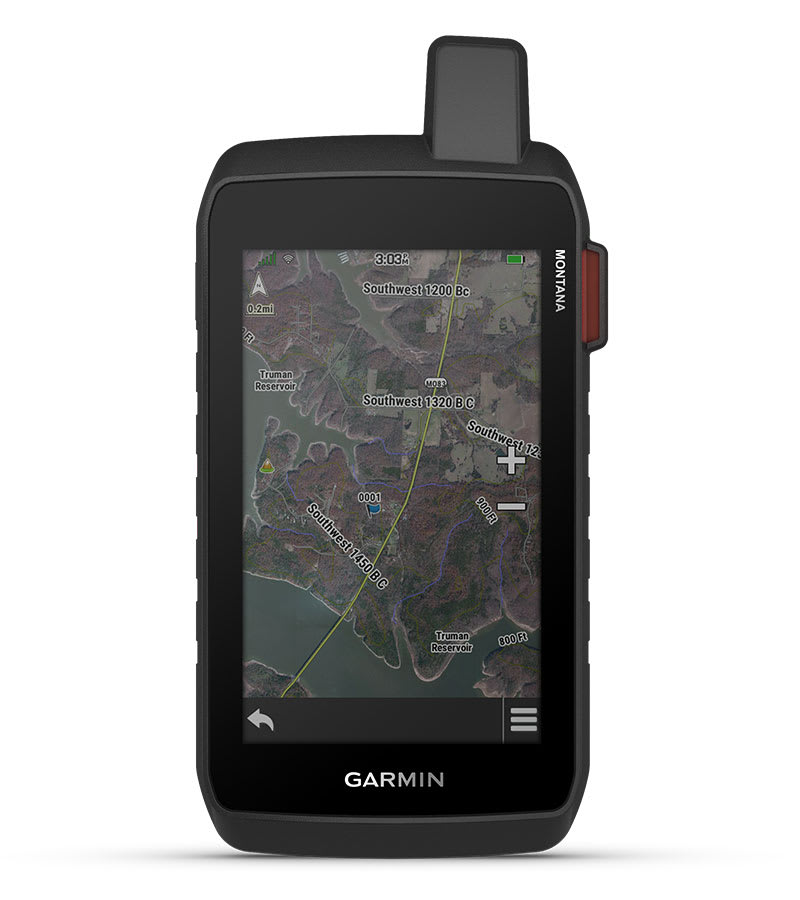
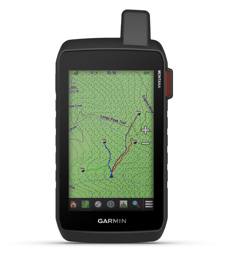
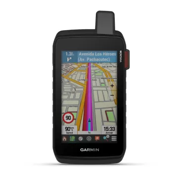
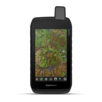
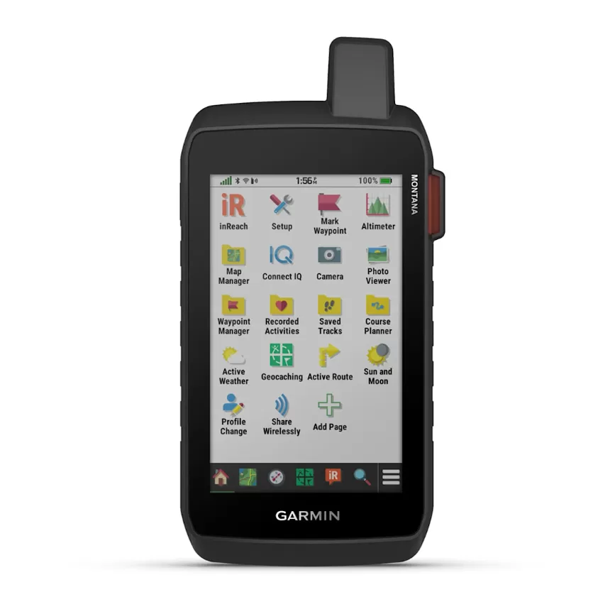
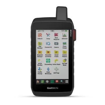
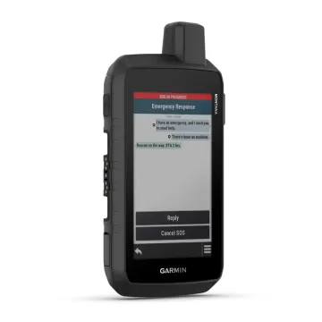
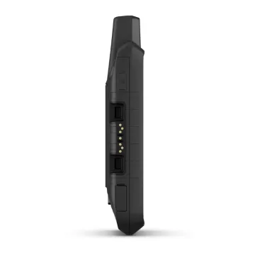
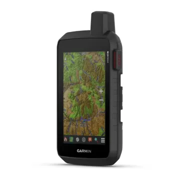
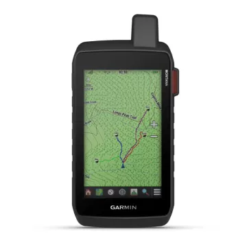
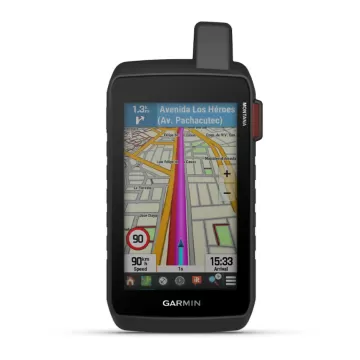
×

Cart

Subtotal:
Garmin Coach - твојот бесплатен персонален тренер - линк  

GARMIN Montana 760i

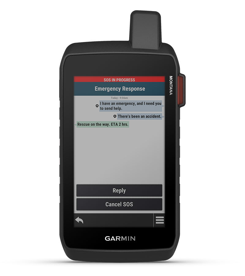
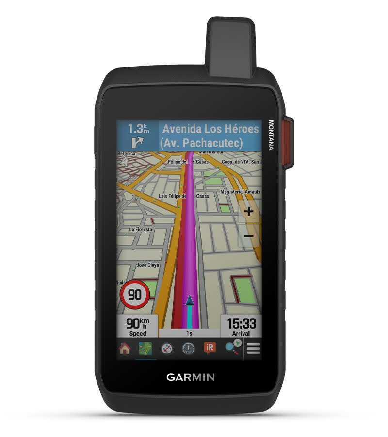
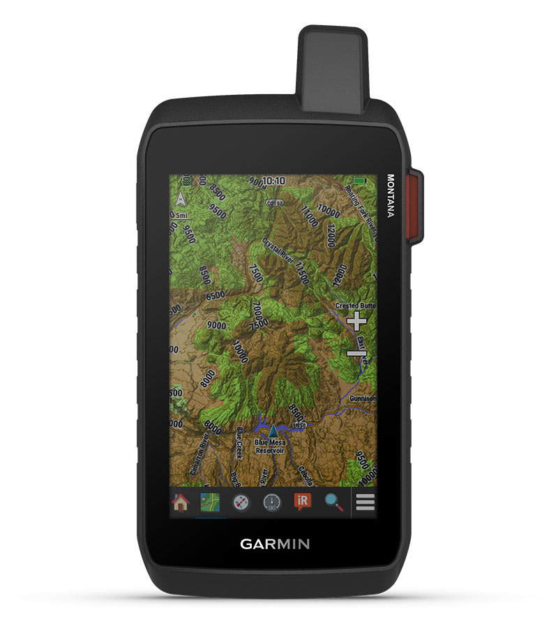
Добијте напредни функции на отворено - плус технологија inReach за двонасочни пораки и интерактивни SOS предупредувања - во цврст формат од 5 инчи кој е идеален за навигација при пешачење, возење велосипед, кајак, ATV и друго.

58.880 ден.
Достапност : Бесплатна достава во Македонија. Рок за испорака 1-3 работни дена.

STAY ON TRACK AND IN TOUCH WHILE CAPTURING YOUR ADVENTURES

Get advanced outdoor features, inReach satellite technology for two-way messaging and interactive SOS alerts1 plus a built-in camera — all housed in a rugged 5-inch format that’s ideal for navigation on foot, bike, kayak, ATV and more.

LARGE 5-INCH GLOVE-FRIENDLY TOUCHSCREEN

PRELOADED ROUTABLE TOPOGRAPHIC MAPS WITH LANDMARKS

STAY IN TOUCH WITH INREACH MESSAGING AND 24/7 SOS1

USE THE BUILT-IN CAMERA TO SNAP PICS AND TAG THE LOCATION

SATELLITE IMAGERY SHOWS VIVID OVERHEAD VIEWS OF YOUR ROUTE

WHAT YOU'LL LOVE

GLOBAL CONNECTIVITY

With an active inReach subscription, you can stay connected even when your adventures go off grid. Instead of relying on smartphone coverage, now your messages, SOS and tracking are transferred via the 100% global Iridium® satellite network1.

BUILT-IN CAMERA

Capture images of your adventures with this Montana 760i device, featuring an integrated 8-megapixel autofocus camera. It geotags photos with coordinates, so you can navigate back to favourite sites in the future.

RUGGED BY DESIGN

This durable, water-resistant handheld is tested to meet MIL-STD 810 for thermal, shock, water and vibration. It features a glove-friendly 5-inch touchscreen and is compatible with a variety of robust mounting solutions (sold separately) to best suit your activities.

TOPOACTIVE MAPS

To navigate your adventures, use preloaded topographical maps. View terrain contours, elevations, coastlines, rivers, landmarks and more.

SATELLITE VIEWS

Access subscription-free, high-resolution satellite imagery with direct-to-device downloads over Wi-Fi® connectivity. See photorealistic overhead views of routes and surrounding terrain, and easily create waypoints based on landmarks.

OUTDOOR MAPS+

Add a subscription to Outdoor Maps+ (sold separately), and get ongoing access to a wide variety of premium mapping content and regular updates sent right to your Garmin device via Wi-Fi technology.

EXPLORE THE WORLD. STAY CONNECTED TO HOME.

INREACH FEATURES


TWO-WAY MESSAGING

Exchange text messages with loved ones back home, or communicate via inReach device to inReach device in the field1.

INTERACTIVE SOS

In case of emergency, trigger an interactive SOS message to Garmin Response℠, a 24/7-staffed professional emergency response coordination centre1.

INREACH WEATHER

Available inReach weather forecast service provides detailed updates directly to your Montana handheld or paired devices, so you’ll know what to expect en route1.

Live Tracking

Using your live tracking page, followers can see your progress, ping your device to see your GPS location and exchange messages during your trip1.


NAVIGATION FEATURES


GARMIN EXPLORE™ APP

Pair with the Garmin Explore app to plan and review trip data, plus manage your waypoints, courses and activities.

MULTI-GNSS SUPPORT

Access to GPS and Galileo satellite networks enables Montana 760i to track in more challenging environments than GPS alone.

ABC SENSORS

Navigate your next trail with ABC sensors, including an altimeter for elevation data, barometer to monitor weather and 3-axis electronic compass.

CITY NAVIGATOR® MAPS

Seamlessly transition from trails to road navigation with preloaded European City Navigator street mapping, which guides your drive with easy-to-follow turn-by-turn directions.

ADDITIONAL MAPS

With 32 GB of onboard memory, you can download even more maps, such as BlueChart® g3 charts for the water (sold separately).


ACTIVE WEATHER

Access up-to-date active weather forecasts via the Garmin Connect™ app on your compatible smartphone

DOG TRACKING

For hunters and trainers, this Montana handheld syncs with your compatible Astro® or Alpha® series handhelds to help track sporting dogs in the field.

WIKILOC TRAILS

This preloaded app lets you easily download hiking, cycling and other Wikiloc trails shared by outdoor enthusiasts like you. Get a free 60-day Wikiloc Premium trial to try this and other exclusive features. Learn more.


ADVENTURE FEATURES


EXPEDITION MODE

Trek far and wide off-grid. Use expedition mode, an ultralow-powered GPS reference, to keep Montana tracking for more than 2 weeks between recharges.

BATTERY OPTIONS

An internal lithium-ion battery pack provides up to 24 hours of battery life in GPS mode and recharges with a standard USB-C® cable.

VEHICLE MOUNTS

A variety of Montana handheld-compatible mounts (sold separately) lets you adapt your navigator for use on ATVs, boats, cars, motorcycles, motorhomes or other vehicles.


TestVar id: 227 userid: 17 name: GARMIN VHF 115i marine radio VIP: 0 cat: 48 subcat: 0 subsubcat: 0 manufacturer: model: status: 1 image1: 17_2024_38161714007508.webp image2: image3: image4: image5: image6: image7: image8: image9: image10: image11: image12: short_description: <h3>Always in touch – even on the water</h3> <ul> <li>Hard-mount marine radio with plug-and-play installation over the NMEA 2000 <sup>®</sup> network</li> <li>Standard Class D Digital Selective Calling (DSC) capabilities (distress calls and direct calls with user-programmed MMSI)</li> <li>In emergencies, DSC can increase your chances of a speedy rescue</li> <li>Transmission power of 25 watts and integrated GPS</li> <li>Pre-programmed with international marine radio channels</li> </ul> description: Communication is crucial on the water. The VHF 115i radio lets you stay in touch with shore and other boats in the area. So you are always in communication - no matter where you are or where you are going. A higher level of security With 25 watts of transmit power, fishermen, sailors and skippers can sail knowing they can call for help with the VHF 115i radio in the event of an emergency. &nbsp; Good communication on the water The device is easy to assemble and use. Plug and play with compatible Garmin chartplotters and multifunction displays via the NMEA 2000 network. The VHF 115i offers standard Class D DSC functions (distress calls and direct calls with user-programmed MMSI). International marine radio channels are already pre-programmed on the radio. It is also compatible with NMEA 0183. Communicate with style You should like your helm. That's why the VHF 115i marine radio is a great companion for the GPSMAP ® 7x2/9x2, GPMAP 10x2/12x2, GPSMAP 7400/7600, and GPSMAP 8400/8600 chartplotters and multifunction displays. characteristics: meta_title: meta_keywords: meta_description: url: measure: order_by: 0 date_created: 2024-10-14 15:55:14 width: profile: diameter: fuel_efficiency: wet_grip: noise: image: 17_2024_38161714007508.webp price: 29780.00 price2: 0.00 item_id: 227

Слични продукти